Jesuit Trained Molly Burhans' Mapping Game (Project Insight 2.0)
updated October 12, 2019

(Former Jesuit Superior General Lorenzo Ricci-esque) Nick Fury to Captain America regarding "Project Insight" in Captain America: The Winter Soldier (2014): https://youtu.be/Ntn7zCo1Cpc?t=190
"We are going to neutralize a lot of threats before they even happen."
Cap: "Thought the punishment usually came after the crime."
Fury: "We can't afford to wait that long."
Cap: "Who's 'We'?"
Fury: "After New York*, I convinced the World Security Council we needed a quantum surge in threat analysis. For once we're way ahead of the curve."

Molly Burhans' October 4, 2019 Tweet:
https://twitter.com/MollyAHBurhans/status/1180306035753525248
A map is an expression of celebration and gratitude of all the magnificent geological, hydrological, botanical, human, climatic, topographic +more of these systems that transcend ontologies. A map is an exuberant exploration, necessary information, and a prayer at the same time.
https://cruxnow.com/church-in-the-usa/2019/10/08/u-n-honors-catholic-activist-using-data-to-fight-climate-change/
Christopher White Oct 8, 2019
NATIONAL CORRESPONDENT
NEW YORK - Greta Thunberg, the 16-year-old Swedish activist who has taken the world by storm through her climate strikes, is practically a household name, even receiving Pope Francis’s encouragement for her efforts demanding global action on the environment.
Lesser known - but also enjoying Vatican backing and U.N. support - is the work of 30-year-old, Molly Burhans, who while initially discerning to be a nun, discovered that the Catholic Church is one of the world’s largest landowners and is now seeking to steward such property - and the data that goes with it - for the common good.
While explaining her work, Burhans likes to cite the [Roman Catholic**] luminary writer J.R.R. Tolkien who once remarked that he “wisely started with a map.”
“That’s the way to understand the environment and we can’t make sound environmental decisions without them,” she said in an interview with Crux.
It’s been a busy few weeks for Burhans, who took part alongside Thunberg in the New York City climate strike and was one of the presenters at the annual high-level Social Good Summit last month aimed at promoting environmental activism and expertise.
https://www.americamagazine.org/faith/2019/01/11/can-high-tech-maps-help-church-and-save-planet
Michael J. O'Loughlin January 11, 2019
Molly Burhans is the founder of GoodLands, a nonprofit organization that she says aims “to help Catholic communities around the world use their property for good.” That means ensuring the church’s property is in harmony with the environment and the local community while also providing for the financial needs of the church.
Take the issue of climate change. In one video, GoodLands shows how increases in temperature will affect Catholic dioceses, especially when it comes to displacement and famine. One of the purposes of this kind of data imaging, Ms. Burhans says, is to allow church leaders to prepare for life under intense heat waves. Combined with other data, such as the number of health care workers in Catholic hospitals or the availability of lands in nearby areas that are less affected, church leaders can prepare ahead of potential disasters.
Goodlands Founder: Molly Burhans

Geographic System
The Catholic Geographic System is a platform that can help multiple stakeholders communicate and thoughtfully plan how their land can promote environmental and social wellbeing while increasing fiscal sustainability. Our work has already generated massive amounts of location data about the global Catholic network. We are developing an enterprise geographic information system (GIS) that will enable partnering organizations to leverage our data and communicate, plan, and exchange their own data with Catholic entities to greatly enhance each other’s critical mission-driven work around the world.
A central platform for data can increase interoperability among the global Catholic community by providing a hub of Catholic data, knowledge management tools, and data infrastructure that enables efficient and secure access, retrieval and dissemination of information, while providing a platform marketplace for Catholic organizations to share data and help finance their missions. The potential costs savings of a centralized hub of information for Catholic organizations in different sectors, such as health care, education, and relief / aid, are in the magnitude of billions of dollars each year.
The Catholic Geographic System works synergistically with GoodLands’ other programs to bring values and scientific information together in the form of actionable data narratives.
By providing a hub for knowledge management, communities are no longer required to invest in their own data infrastructure. Providing this hub will also reduce costly maintenance and collection redundancy across Catholic organizations. This helps Catholic communities around the world to implement programs more efficiently and to understand their relationship to local conditions. It also makes it possible to respond more effectively to the stewardship calling of Laudato Si’ through a process that is rapid, sustainable, measurable, and globally scalable.
The Catholic Geographic System is a hub of geographic information. The image above illustrates a basic framework for data sharing among various stakeholders with multiple levels of security, collaboration, and use.


Infrastructure
https://good-lands.org/infrastructure-matters/
All the things in our world are located somewhere and are part of some infrastructure, whether it’s the social infrastructure of a community, the green infrastructure of an ecosystem, the utility infrastructure of a sewer system, or the spatial data infrastructure of a geographic information system. In Laudato Si’ Pope Francis says “the fragmentation of knowledge and the isolation of bits of information can actually become a form of ignorance, unless they are integrated into a broader vision of reality.”
Partners etc
https://good-lands.org/partners/
*Georgetown University et al
Canisius College
Molly Burhans, Ashoka Fellow Since 2018
https://www.ashoka.org/en-CA/fellow/molly-burhans
Ashoka History
https://www.ashoka.org/en-CA/story/ashoka%27s-history
Bill Drayton founded Ashoka in 1980 based on the idea that the most powerful force for good in the world is a social entrepreneur: a person driven by an innovative idea that can help correct an entrenched global problem. The world’s leading social entrepreneurs pursue system-changing solutions that permanently alter existing patterns of activity.
Beginning in India in 1981, Ashoka started identifying and supporting the world’s leading social entrepreneurs who have ideas for far-reaching social change. It started by first distilling their unique qualities and pioneering a rigorous global system for vetting and electing them to the Ashoka Fellowship. Four years later, Bill Drayton was awarded a MacArthur Fellowship (“genius” award), and began to work full-time on building the Ashoka organization.
Bill Drayton
https://www.ashoka.org/en-CA/leadership
As a student, [Bill Drayton] founded organizations ranging from Yale Legislative Services to Harvard’s Ashoka Table, an inter-disciplinary weekly forum in the social sciences. He launched Ashoka in 1981. He used the stipend received when elected a MacArthur Fellow in 1984 to devote himself fully to Ashoka. In 2005, he was selected one of America’s Best Leaders by US News & World Report and Harvard’s Center for Public Leadership.
Cartography: "Map-Making"—The Jesuit Visual Artform of Sophistry
https://referenceworks.brillonline.com/entries/jesuit-historiography-online/historiography-of-jesuit-cartography-COM_212546
Robert Batchelor
batchelo@georgiasouthern.edu
Last modified: February 2019
Google Maps is a web mapping service developed by Google. It offers satellite imagery, aerial photography, street maps, 360° panoramic views of streets (Street View), real-time traffic conditions, and route planning for traveling by foot, car, bicycle and air (in beta), or public transportation.
...
In 2005 the Australian Nuclear Science and Technology Organization (ANSTO) complained about the potential for terrorists to use the satellite images in planning attacks, with specific reference to the Lucas Heights nuclear reactor; however, the Australian Federal government did not support the organization's concern. At the time of the ANSTO complaint, Google had colored over some areas for security (mostly in the US), such as the rooftop of the White House and several other Washington, D.C., US buildings.
Google Maps: Good-Lands to Sandy Hook, Newtown, CT—A 26-mile Marathon


Land Ownership: Elizabeth II, Former Queen of Malta, World's Largest "Land-Owner" Next to the Vatican
https://www.businessinsider.com/worlds-biggest-landowners-2011-3#15-ted-turner-1
Thornton McEneryMar 18, 2011, 8:27 AM
[Queen Elizabeth II:]
Land: 6.6 billion acres of land worldwide including Great Britain, Northern Ireland, Canada, Australia and a few other spots here and there. Also, the all-important Falkland Islands.
Background: England's third (and most likely soon to be second) longest serving monarch, Elizabeth II retains royal title over The British Commonwealth and as such manages to keep her face on money throughout the globe.
With her 6.6 billion acres, Elizabeth II is far and away the world's largest landowner, with the closest runner-up (King Abdullah) holding control over a mere 547 million, or about 12% of the lands owned by Her Majesty, The Queen.
[The Vatican:]

(Former Jesuit Superior General Lorenzo Ricci-esque) Nick Fury to Captain America regarding "Project Insight" in Captain America: The Winter Soldier (2014): https://youtu.be/Ntn7zCo1Cpc?t=190
"We are going to neutralize a lot of threats before they even happen."
Cap: "Thought the punishment usually came after the crime."
Fury: "We can't afford to wait that long."
Cap: "Who's 'We'?"
Fury: "After New York*, I convinced the World Security Council we needed a quantum surge in threat analysis. For once we're way ahead of the curve."

Molly Burhans' October 4, 2019 Tweet:
https://twitter.com/MollyAHBurhans/status/1180306035753525248
A map is an expression of celebration and gratitude of all the magnificent geological, hydrological, botanical, human, climatic, topographic +more of these systems that transcend ontologies. A map is an exuberant exploration, necessary information, and a prayer at the same time.
https://cruxnow.com/church-in-the-usa/2019/10/08/u-n-honors-catholic-activist-using-data-to-fight-climate-change/
Christopher White Oct 8, 2019
NATIONAL CORRESPONDENT
NEW YORK - Greta Thunberg, the 16-year-old Swedish activist who has taken the world by storm through her climate strikes, is practically a household name, even receiving Pope Francis’s encouragement for her efforts demanding global action on the environment.
Lesser known - but also enjoying Vatican backing and U.N. support - is the work of 30-year-old, Molly Burhans, who while initially discerning to be a nun, discovered that the Catholic Church is one of the world’s largest landowners and is now seeking to steward such property - and the data that goes with it - for the common good.
...
While explaining her work, Burhans likes to cite the [Roman Catholic**] luminary writer J.R.R. Tolkien who once remarked that he “wisely started with a map.”
“That’s the way to understand the environment and we can’t make sound environmental decisions without them,” she said in an interview with Crux.
It’s been a busy few weeks for Burhans, who took part alongside Thunberg in the New York City climate strike and was one of the presenters at the annual high-level Social Good Summit last month aimed at promoting environmental activism and expertise.
https://www.americamagazine.org/faith/2019/01/11/can-high-tech-maps-help-church-and-save-planet
Michael J. O'Loughlin January 11, 2019
Molly Burhans is the founder of GoodLands, a nonprofit organization that she says aims “to help Catholic communities around the world use their property for good.” That means ensuring the church’s property is in harmony with the environment and the local community while also providing for the financial needs of the church.
Take the issue of climate change. In one video, GoodLands shows how increases in temperature will affect Catholic dioceses, especially when it comes to displacement and famine. One of the purposes of this kind of data imaging, Ms. Burhans says, is to allow church leaders to prepare for life under intense heat waves. Combined with other data, such as the number of health care workers in Catholic hospitals or the availability of lands in nearby areas that are less affected, church leaders can prepare ahead of potential disasters.
Goodlands Founder: Molly Burhans

https://good-lands.org/team/
Molly combines her passion for people and the planet with her experience in design thinking, business development, and scientific research to understand and transform complex systems, manage diverse teams, and communicate ideas and processes through broadly-accessible media that brings people together.
Molly is an Ashoka Fellow (2018). Molly was the Chief Cartographer for the first global data-based maps of the Catholic Church and has exhibited these on numerous occasions in the Vatican.
Molly has an M.S. in Ecological Design from the Conway School, where she was her class’ Sustainable Communities Initiative Fellow, and a B.A. in Philosophy from [Jesuit] Canisius College. She worked in a yeast genetics lab and has designed and developed professional graphic and web media for over ten years, some of which been featured in publications such as Landscape Architecture Magazine, Nucleic Acids Research, and the Association for Advancement of Artificial Intelligence proceedings. She co-founded GroOperative, Inc. 5(a), an indoor-vertical farming worker-owned cooperative in Buffalo, NY, USA in 2013. She has been involved with the Vatican Youth Symposium, Vatican Arts and Technology Council, United Nations Youth Assembly, the Buckminster Fuller Catalyst program and is an Echoing Green Fellowship finalist. She has also been an invited speaker at numerous conferences and institutions, including but not limited to Harvard University, Yale University, Esri, the Pontifical Academy of Sciences, and ICT4D
Geographic System
https://good-lands.org/catholic-geographic-system/
A central platform for data can increase interoperability among the global Catholic community by providing a hub of Catholic data, knowledge management tools, and data infrastructure that enables efficient and secure access, retrieval and dissemination of information, while providing a platform marketplace for Catholic organizations to share data and help finance their missions. The potential costs savings of a centralized hub of information for Catholic organizations in different sectors, such as health care, education, and relief / aid, are in the magnitude of billions of dollars each year.
The Catholic Geographic System works synergistically with GoodLands’ other programs to bring values and scientific information together in the form of actionable data narratives.
By providing a hub for knowledge management, communities are no longer required to invest in their own data infrastructure. Providing this hub will also reduce costly maintenance and collection redundancy across Catholic organizations. This helps Catholic communities around the world to implement programs more efficiently and to understand their relationship to local conditions. It also makes it possible to respond more effectively to the stewardship calling of Laudato Si’ through a process that is rapid, sustainable, measurable, and globally scalable.
The Catholic Geographic System is a hub of geographic information. The image above illustrates a basic framework for data sharing among various stakeholders with multiple levels of security, collaboration, and use.


Infrastructure
https://good-lands.org/infrastructure-matters/
All the things in our world are located somewhere and are part of some infrastructure, whether it’s the social infrastructure of a community, the green infrastructure of an ecosystem, the utility infrastructure of a sewer system, or the spatial data infrastructure of a geographic information system. In Laudato Si’ Pope Francis says “the fragmentation of knowledge and the isolation of bits of information can actually become a form of ignorance, unless they are integrated into a broader vision of reality.”
Partners etc
https://good-lands.org/partners/
*Georgetown University et al
Canisius College
https://en.wikipedia.org/wiki/Canisius_College
Canisius College /kəˈniːʃəs/ is a private Jesuit college in Buffalo, New York. It was founded in 1870 by Jesuits from Germany and is named after St. Peter Canisius.Molly Burhans, Ashoka Fellow Since 2018
https://www.ashoka.org/en-CA/fellow/molly-burhans
Ashoka History
https://www.ashoka.org/en-CA/story/ashoka%27s-history
Bill Drayton founded Ashoka in 1980 based on the idea that the most powerful force for good in the world is a social entrepreneur: a person driven by an innovative idea that can help correct an entrenched global problem. The world’s leading social entrepreneurs pursue system-changing solutions that permanently alter existing patterns of activity.
Beginning in India in 1981, Ashoka started identifying and supporting the world’s leading social entrepreneurs who have ideas for far-reaching social change. It started by first distilling their unique qualities and pioneering a rigorous global system for vetting and electing them to the Ashoka Fellowship. Four years later, Bill Drayton was awarded a MacArthur Fellowship (“genius” award), and began to work full-time on building the Ashoka organization.
Bill Drayton
https://www.ashoka.org/en-CA/leadership
As a student, [Bill Drayton] founded organizations ranging from Yale Legislative Services to Harvard’s Ashoka Table, an inter-disciplinary weekly forum in the social sciences. He launched Ashoka in 1981. He used the stipend received when elected a MacArthur Fellow in 1984 to devote himself fully to Ashoka. In 2005, he was selected one of America’s Best Leaders by US News & World Report and Harvard’s Center for Public Leadership.
Cartography: "Map-Making"—The Jesuit Visual Artform of Sophistry
https://referenceworks.brillonline.com/entries/jesuit-historiography-online/historiography-of-jesuit-cartography-COM_212546
Robert Batchelor
batchelo@georgiasouthern.edu
Last modified: February 2019
Jesuit cartography, a vast and lively area of historical scholarship, does not as yet have a proper history. Some have questioned whether such an enterprise could ever encompass the global variety of early modern and modern productions by members of the order. Only in 1991 did the historian of cartography John Brian Harley (1932–91) first try to sum up the Jesuit cartographic project as an extension of Renaissance “arts of persuasion,” noting that “it is clear that the Jesuits more than other religious orders of early modern Europe valued maps and geography for the control of missionary space.”
...
Thoroughly “modern,” such maps represented a kind of network phenomenon of displaying earthly connections, one perhaps connected with the effort to develop new forms of subjectivity in the context of the Counter-Reformation. These two poles—missionary persuasion derived from confident universalism versus a new global subjectivity emerging from disruption—have largely shaped the broader historiographic debate about the significance of Jesuit mapping projects.
...
Jesuit cartography was very much a project rooted not only in Jesuit and Catholic science in the late sixteenth century, with ambitions to use geometry as a way of articulating a universal account of space and time, but also in the imperial efforts of empires like the Spanish and the Ming to gain both regional and global leverage.
Molly Burhans' Global Database Map of the Catholic Church
https://grottonetwork.com/make-an-impact/transform/catholic-church-combats-climate-change
The first time Molly Burhans visited the Vatican, she was there as a 26-year-old to ask permission to make the first-ever global database map of the Catholic Church. She’s not just painting lines on a globe, though — her maps gather layers of geographical, political, economic, and ecological data to empower the Church to use her lands wisely, especially in the fight against climate change.
...
If we’re going to address climate change sufficiently, then the Catholic Church and other faiths and anyone that owns a lot of land is going to play a very significant role in that movement.
How much land does the Catholic Church have?
The Catholic Church is very likely one of the largest, if not the largest, non-governmental land holder in the world just based on the sheer number of institutions and parishes affiliated with it. Some people say it might be the size of France or the size of Spain. I don’t think we can actually make a proper estimate about acreage until we have it mapped. We can just know that it’s a lot.
Burhans tweets a welcome to USA to Greta, August 28, 2019:
https://twitter.com/MollyAHBurhans/status/1166873083032064000
Welcome to the United States of America @GretaThunberg - thank you for inspiring environmental action and showing how each of us can (and need to) use what we have, wherever we are in life, to move the world towards a more verdant, livable, and just future for all.
Modern Cartography: Google Earth and Google Maps
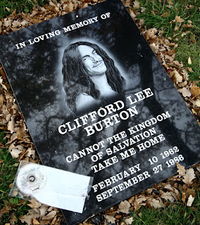
Note Google and the Jesuit Order share a birthday: September 27th—a coincidence?
https://en.wikipedia.org/wiki/Google_Earth
Google Earth is a computer program that renders a 3D representation of Earth based primarily on satellite imagery. The program maps the Earth by superimposing satellite images, aerial photography, and GIS data onto a 3D globe, allowing users to see cities and landscapes from various angles. Users can explore the globe by entering addresses and coordinates, or by using a keyboard or mouse. The program can also be downloaded on a smartphone or tablet, using a touch screen or stylus to navigate. Users may use the program to add their own data using Keyhole Markup Language and upload them through various sources, such as forums or blogs. Google Earth is able to show various kinds of images overlaid on the surface of the earth and is also a Web Map Service client.
...
Google Earth has been viewed by some as a threat to privacy and national security, leading to the program being banned in multiple countries. Some countries have requested that certain areas be obscured in Google's satellite images, usually areas containing military facilities.
...
Jesuit cartography was very much a project rooted not only in Jesuit and Catholic science in the late sixteenth century, with ambitions to use geometry as a way of articulating a universal account of space and time, but also in the imperial efforts of empires like the Spanish and the Ming to gain both regional and global leverage.
Molly Burhans' Global Database Map of the Catholic Church
https://grottonetwork.com/make-an-impact/transform/catholic-church-combats-climate-change
The first time Molly Burhans visited the Vatican, she was there as a 26-year-old to ask permission to make the first-ever global database map of the Catholic Church. She’s not just painting lines on a globe, though — her maps gather layers of geographical, political, economic, and ecological data to empower the Church to use her lands wisely, especially in the fight against climate change.
...
If we’re going to address climate change sufficiently, then the Catholic Church and other faiths and anyone that owns a lot of land is going to play a very significant role in that movement.
How much land does the Catholic Church have?
The Catholic Church is very likely one of the largest, if not the largest, non-governmental land holder in the world just based on the sheer number of institutions and parishes affiliated with it. Some people say it might be the size of France or the size of Spain. I don’t think we can actually make a proper estimate about acreage until we have it mapped. We can just know that it’s a lot.
Burhans tweets a welcome to USA to Greta, August 28, 2019:
https://twitter.com/MollyAHBurhans/status/1166873083032064000
Welcome to the United States of America @GretaThunberg - thank you for inspiring environmental action and showing how each of us can (and need to) use what we have, wherever we are in life, to move the world towards a more verdant, livable, and just future for all.
Modern Cartography: Google Earth and Google Maps
Note Google and the Jesuit Order share a birthday: September 27th—a coincidence?
https://en.wikipedia.org/wiki/Google_Earth
Google Earth is a computer program that renders a 3D representation of Earth based primarily on satellite imagery. The program maps the Earth by superimposing satellite images, aerial photography, and GIS data onto a 3D globe, allowing users to see cities and landscapes from various angles. Users can explore the globe by entering addresses and coordinates, or by using a keyboard or mouse. The program can also be downloaded on a smartphone or tablet, using a touch screen or stylus to navigate. Users may use the program to add their own data using Keyhole Markup Language and upload them through various sources, such as forums or blogs. Google Earth is able to show various kinds of images overlaid on the surface of the earth and is also a Web Map Service client.
...
Google Earth has been viewed by some as a threat to privacy and national security, leading to the program being banned in multiple countries. Some countries have requested that certain areas be obscured in Google's satellite images, usually areas containing military facilities.
...
Google Earth's imagery is displayed on a digital globe, which displays the planet's surface using a single composited image from a far distance.
https://en.wikipedia.org/wiki/Google_Maps
...
In 2005 the Australian Nuclear Science and Technology Organization (ANSTO) complained about the potential for terrorists to use the satellite images in planning attacks, with specific reference to the Lucas Heights nuclear reactor; however, the Australian Federal government did not support the organization's concern. At the time of the ANSTO complaint, Google had colored over some areas for security (mostly in the US), such as the rooftop of the White House and several other Washington, D.C., US buildings.
Google Maps: Good-Lands to Sandy Hook, Newtown, CT—A 26-mile Marathon


Land Ownership: Elizabeth II, Former Queen of Malta, World's Largest "Land-Owner" Next to the Vatican
https://www.businessinsider.com/worlds-biggest-landowners-2011-3#15-ted-turner-1
Thornton McEneryMar 18, 2011, 8:27 AM
[Queen Elizabeth II:]
Land: 6.6 billion acres of land worldwide including Great Britain, Northern Ireland, Canada, Australia and a few other spots here and there. Also, the all-important Falkland Islands.
Background: England's third (and most likely soon to be second) longest serving monarch, Elizabeth II retains royal title over The British Commonwealth and as such manages to keep her face on money throughout the globe.
With her 6.6 billion acres, Elizabeth II is far and away the world's largest landowner, with the closest runner-up (King Abdullah) holding control over a mere 547 million, or about 12% of the lands owned by Her Majesty, The Queen.
[The Vatican:]
The 110 acres of The Holy See that constitute Vatican City. Also, roughly 177 million more acreage of various lands owned by the Catholic Church throughout the globe, including the hundreds of Vatican embassies that are legally titled to The Holy See as an independent nation.
Elizabeth II
https://en.wikipedia.org/wiki/Order_of_Saint_John_(chartered_1888)
Elizabeth II—Head of the Commonwealth since 1952—is at the apex of the Order of Saint John as its Sovereign Head ....

But Who's the Real Boss?


*"New York"; Viet D. Dinh; The Patriot Act; from:
https://hawkeye134.blogspot.com/2019/09/greta-thunberg-pope-and-other-sundries.html
The 9/11 Example
https://www.wired.com/2004/02/the-patriot-act-is-your-friend/
Assistant Attorney General Viet Dinh, who authored the Patriot Act, has been called a "political pit bull" but prefers to be called an "attendant of freedom." Viet Dinh has been called a "political pit bull" and "a foot soldier" for Attorney General John Ashcroft. But the 36-year-old author of the Patriot Act prefers to be called an "attendant of freedom."
In May 2001, the professor of law at Georgetown University was tapped by the Justice Department to work for two years as an assistant attorney general, working primarily on judicial nominations for the department. But three months later the World Trade Center towers collapsed, and Dinh was drafted to work on the USA Patriot Act, a bill that would give the government some of its most controversial surveillance powers. The bill, coupled with the government's subsequent treatment of immigrants and native-born citizens, prompted critics to charge the administration with overthrowing "800 years of democratic tradition."
Perhaps Viet D. Dinh is a "political pit bull" and "foot soldier" for another general—the Superior General of the Jesuit Order—Peter Hans Kolvenbach who was Jesuit Superior General September 13, 1983 - January 14, 2008).
Who is Viet D. Dinh?
https://en.wikipedia.org/wiki/Viet_D._Dinh
Viet D. Dinh (Vietnamese: Đinh Đồng Phụng Việt; born February 22, 1968) is a lawyer and a conservative legal scholar[1] who served as an Assistant Attorney General of the United States from 2001 to 2003, under the presidency of George W. Bush. Born in Saigon,[2] in the former South Vietnam, he was the chief architect of the USA PATRIOT Act and is a former member of the Board of Directors of News Corporation.[3][4][5]
...
Dinh is Professor of Law at Georgetown University Law Center.
Georgetown University is a Jesuit Institution.
**Doc Felipe's article on J.R.R. Tolkien, the "Lord of the Jesuit Tales":
https://johnnycirucci.com/tolkien-lewis/


Comments
Post a Comment